Flood Watch and Strong Storms Expected Saturday Across Northeast Florida and Southeast Georgia
Saturday is expected to bring cloudy skies, scattered showers, and thunderstorms across much of Florida and Southeast Georgia. For some areas, flooding is already becoming a serious concern.
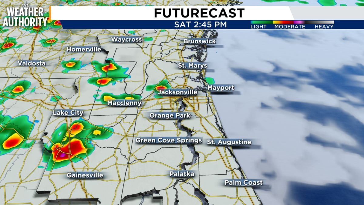
Showers are forecast to move east out of the Suwannee Valley, leading to more widespread thunderstorm development from I-75 toward the Atlantic Coast.
Main Storm Threats
The strongest storms could bring several hazards, including gusty winds between 40 and 50 mph, frequent lightning, and heavy rain.
Some areas may see localized rainfall totals of 2 to 3 inches, especially where storms move slowly or repeatedly pass over the same locations.
Storms are expected to move off the Atlantic Coast late in the afternoon. However, scattered showers may continue through sunset and into the late evening hours.
Flood Watch in Effect for Southeast Georgia
Flooding remains a major concern in Southeast Georgia, where a Flood Watch is in effect until 11 p.m.
The ground is already saturated after 4 to 10 inches of rain fell across the region on Friday. Because of that, any additional heavy rain could quickly worsen flooding problems.
Thunderstorms on Saturday may produce 2 to 3 inches of rain per hour in some locations, especially along and north of U.S. Highway 82, where flood conditions could become more dangerous.
Saturday Temperatures and Winds
Cloud cover will keep temperatures slightly lower than usual on Saturday afternoon. Most inland areas are expected to reach the upper 80s, while temperatures near the I-95 corridor and across north-central Florida may climb to around 90 degrees.
Winds will come from the west at 5 to 10 mph before shifting west-northwest later in the afternoon.
Sunday Starts Summer With Dangerous Heat
Sunday marks the first day of summer, and temperatures are expected to reflect that seasonal shift.
Highs are forecast to reach the mid-90s, making the longest day of the year feel extremely hot. Heat index values could climb into the triple digits, with some locations feeling as hot as 107 degrees.
Saturday’s weather will bring strong storms, heavy rain, and flooding concerns to Northeast Florida and Southeast Georgia, especially in areas already soaked by Friday’s rainfall. While storms should gradually move offshore later in the day, scattered showers may linger into the evening. By Sunday, the focus shifts from flooding to intense summer heat, with feels-like temperatures potentially reaching dangerous levels.